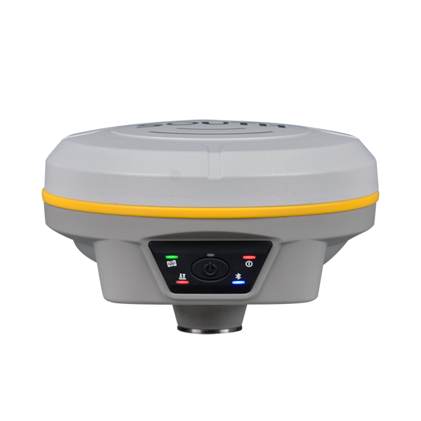
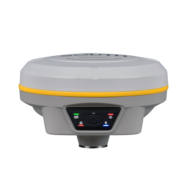
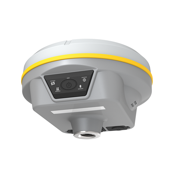
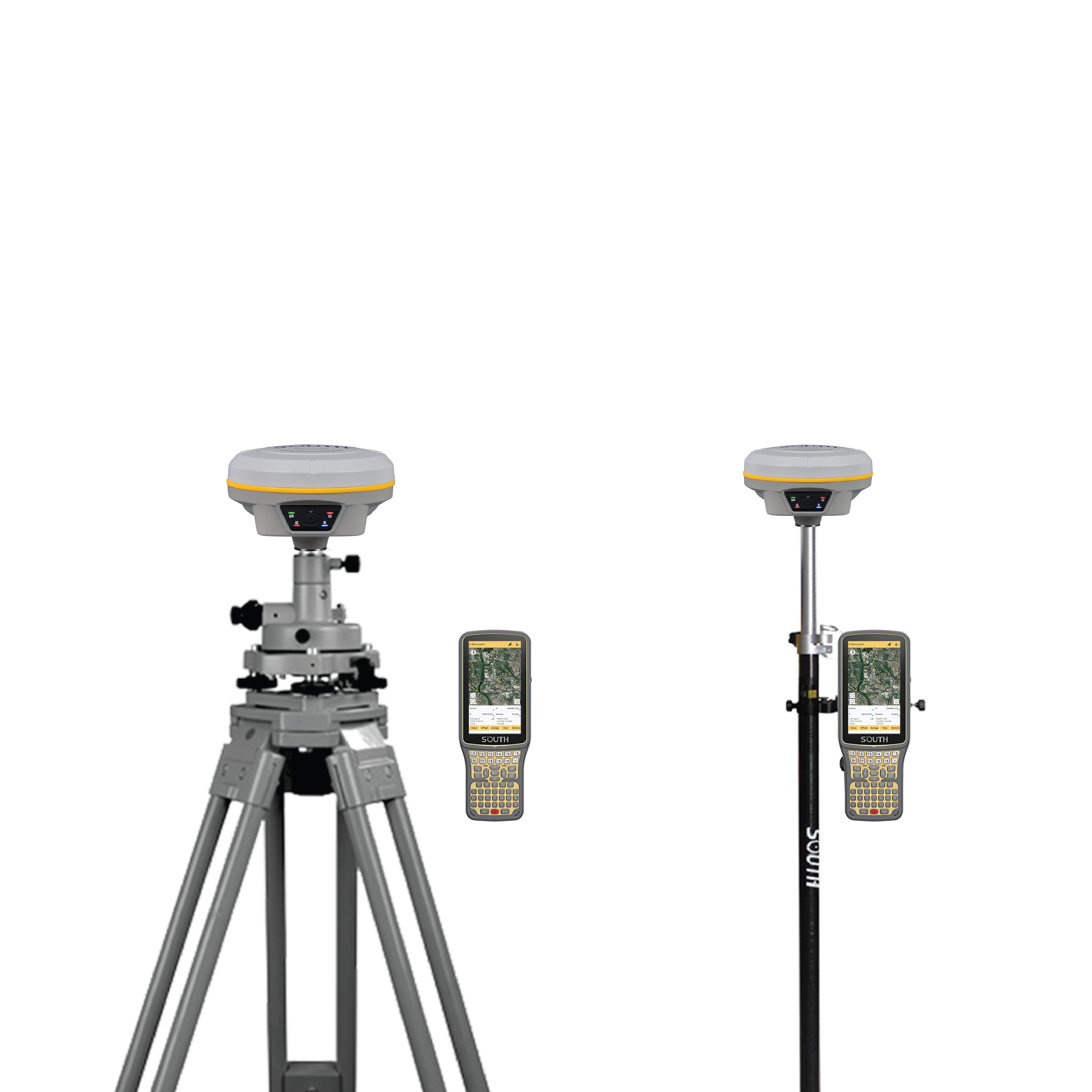
เครื่องรับสัญญาณดาวเทียม GNSS สถานีเคลื่อนที่ (Rover Station)
SOUTH รุ่น GALAXY G3
รายละเอียดคุณลักษณะเฉพาะ
1. สามารถรับและบันทึกข้อมูลสัญญาณดาวเทียมในรูปแบบ
GPS: L1, L1C, L2C, L2P, L5 GLONASS : L1C/A, L1P, L2C/A, L2P, L3 BDS : BDS-2: B1I, B2I, B3I, BDS-3:B1I, B3I, B1C, B2a, B2b GALILEO : E1, E5A, E5B, E6C,
AltBOC, SBAS(WAAS/MSAS/EGNOS/GAGAN) : L1, IRNSS
: L5, QZSS : L1, L2C, L5, MSS
L-band : BDS-PPP
2. มีความถี่ในการบันทึกข้อมูลสัญญาณไม่น้อยกว่า
20 Hz
3. มีช่องการรับสัญญาณ 1598 ช่อง
4. สามารถสลับการทำงานให้เป็นสถานีฐาน (Base) หรือสถานีเคลื่อนที่
(Rover) ได้ในเครื่องเดียว
5. มีความถูกต้องของการรังวัดด้วยวิธี Real
Time Kinematic ทางราบ ไม่เกิน 8 mm ± 1 ppm และทางดิ่ง
15 mm ± 1 ppm
6. มีความถูกต้องของการรังวัดด้วยวิธี Static ทางราบ
ไม่เกิน 2.5 mm ± 0.5 ppm และทางดิ่ง
5 mm ± 0.5 ppm
7. สามารถทำการรังวัดแบบ Code
differential GNSS ได้ และมีความถูกต้องของการรังวัดทางราบ ไม่เกิน 0.25 m ± 1 ppm และทางดิ่ง
0.50 m ± 1 ppm
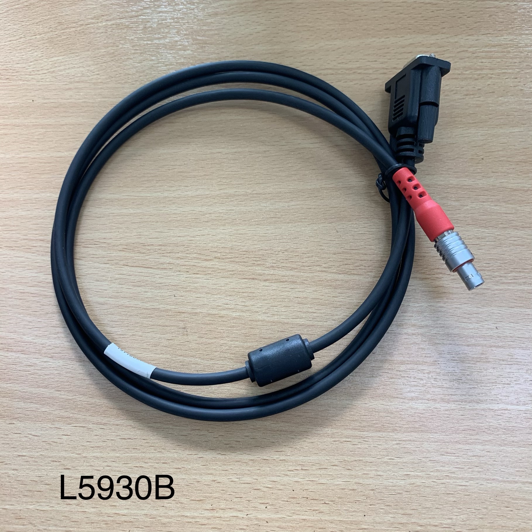
8. สามารถเชื่อมต่อคอมพิวเตอร์เพื่อนำข้อมูลดิบออกได้
โดยมีช่องทางการเชื่อมต่อเป็น RS232 แบบ Type-C
9. วิทยุภายในกำลังส่ง 2W สามารถทำงานได้ในระยะ
8 กม. และช่วงคลื่นความถี่ 410 – 470 MHz
10. รองรับระบบ NFC และการเชื่อมต่อ
Bluetooth 3.0 / 4.1 และ Bluetooth
2.1 + EDR เป็นอย่างน้อย
11. รองรับค่าปรับแก้ในรูปแบบ RTCM 2.3, RTCM 3.0, RTCM 3.1, RTCM 3.2
ได้เป็นอย่างน้อย
12. รองรับรูปแบบ Output Format
: NMEA-0813, SOUTH Binary, VRS, FKP, MAC, NTRIP protocol, PJK
plane เป็นอย่างน้อย
13. มีหน่วยความจำภายใน 4 GB รับรองการต่อหน่วยความจำเพิ่มสูงสุดถึง
64 GB มีระบบ Automatic
Cycle ลบข้อมูลที่เก่าที่สุดโดยอัตโนมัติ หากหน่วยความจำเต็ม
14. ช่วงอุณหภูมิการทำงาน -45ºC ถึง 75 ºC
15. รองรับโปรโตคอล SOUTH,
HUACE, Hi-target, Satel, Trimtalk450s,
Farlink
16. ตัวเครื่องมีมาตรฐานกันน้ำและฝุ่นละอองระดับ IP68
ทนต่อการตกกระแทกจากบนโพลที่ความสูง 2 เมตร
17. รองรับการจ่ายไฟฟ้ากระแสตรง ที่ 6-28V DC
18. มีแบตเตอรี่ภายในแบบ Li-ion ขนาด
7.2V 6800 mAh สามารถใช้งานได้
15 ชั่วโมงในโหมด Rover Bluetooth
19. มีน้ำหนักไม่เกิน 790 กรัม รวมแบตเตอรี่
20. มีปุ่มควบคุมการปฏิบัติการ 1 ปุ่ม พร้อมไฟ LED แสดงสถานการณ์ทำงาน
จำนวน 5 ดวง
21. สามารถควบคุมการทำงานผ่าน Web UI ได้ด้วยสัญญาณ
WiFi
22. มี Voice Guide เพื่อสนับสนุนการทำงาน
23. มีระบบ IMU ในตัว
และรองรับ Tilt Survey ที่สูงสุด
60 องศา
เครื่องควบคุมการเครื่องรับสัญญาณดาวเทียม
GNSS (Controller) ยี่ห้อ SOUTH รุ่น H6 จำนวน
1 เครื่อง
รายละเอียดคุณลักษณะเฉพาะ
1. ปฏิบัติการด้วยระบบ Android
8.1
2. มีหน้าจอแสดงผลขนาด 5 นิ้ว แบบ capacitive
touch screen ความละเอียด 720 x 1280 dpi
3. มีหน่วยความจำชนิด RAM 4 GB และ ROM 64 GB
4. ประมวลผลด้วย CPU แบบ Octa-core
2.0GHz
5. สามารถเชื่อมต่อ Bluetooth
v4.1 และ WiFi IEEE 802.11
a/b/g/n/ac ได้
6. มีกล้องดิจิตอลในตัว ความละเอียดไม่น้อยกว่า
13.0 MP
7. มีช่องเชื่อมต่อแบบ Mini
USB (OTG)
8. มีช่องใส่ SIM Card จำนวน 2
ช่อง
9. มีแบตเตอรี่ภายในแบบ Li-ion ขนาด
9200 mAh สามารถทำงานได้ต่อเนื่อง
15 ชั่วโมง หรือสแตนบายได้สูงสุด 240 ชั่วโมง
10. สามารถรับสัญญาณดาวเทียมจากระบบ GPS,
GLONASS และ BDS ได้
11. มีโปรแกรมสำเร็จรูป
สำหรับควบคุมการทำงานของเครื่องรับสัญญาณดาวเทียม ที่มีลิขสิทธิ์ถูกต้อง
และเครื่องหมายการค้าเดียวกันกับเครื่องรับสัญญาณดาวเทียม
เพื่อทำการควบคุมการทำงาน และแสดงผลข้อมูลสถานะดาวเทียม บันทึก จัดเก็บ
และส่งออกข้อมูล
12. ตัวเครื่องมีความแข็งแรงทนทาน
สามารถทนต่อการกันน้ำและฝุ่นระดับ IP 67 และสามารถกันการตกกระแทกที่ความสูง
1.5 เมตรได้
ชุด Base Station ประกอบด้วย
1. RTK (Base Station) จำนวน 1ตัว
2. กล่องแข็งสำหรับบรรจุชุดเครื่องรับสัญญาณดาวเทียม GNSS และอุปกรณ์ประกอบ จำนวน 1 กล่อง
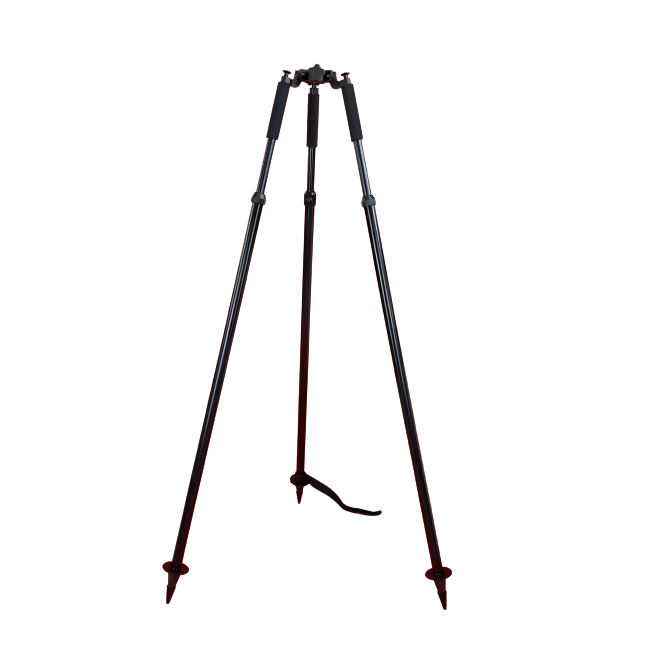
3. ขาตั้ง RTK จำนวน 1 ขา
4.
ชุด Rover Station ประกอบด้วย
1. RTK (Rover Station) จำนวน 1ตัว
2. กล่องแข็งสำหรับบรรจุชุดเครื่องรับสัญญาณดาวเทียม GNSS และอุปกรณ์ประกอบ จำนวน 1 ชุด
3. เครื่องควบคุมตัวรับสัญญาณ (Controller) จำนวน 1 เครื่อง พร้อมที่จับ
4.
Specification
GNSS Features Channels 1598 GPS L1, L1C, L2C, L2P, L5 GLONASS L1C/A,L1P,L2C/A,L2P,L3* BDS BDS-2: B1I, B2I, B3I
BDS-3: B1I, B3I, B1C, B2a, B2b* GALILEOS E1, E5A, E5B, E6C, AltBOC* SBAS(WAAS/MSAS/EGNOS/GAGAN) L1* IRNSS L5* QZSS L1, L2C, L5* MSS L-Band BDS-PPP Positioning output rate 1Hz~20Hz Initialization time < 10s Initialization reliability > 99.99% Positioning Precision Code differential GNSS positioning Horizontal: 0.25 m + 1 ppm RMS
Vertical: 0.50 m + 1 ppm RMS Static(long observations) Horizontal: 2.5 mm + 1 ppm RMS
Vertical: 3 mm + 0.4 ppm RMS Static Horizontal: 2.5 mm + 0.5 ppm RMS
Vertical: 3.5 mm + 0.5 ppm RMS Rapid static Horizontal: 2.5 mm + 0.5 ppm RMS
Vertical: 5 mm + 0.5 ppm RMS PPK Horizontal: 3 mm + 1 ppm RMS
Vertical: 5 mm + 1 ppm RMS RTK(UHF) Horizontal: 8 mm + 1 ppm RMS
Vertical: 15 mm + 1 ppm RMS RTK(NTRIP) Horizontal: 8 mm + 0.5 ppm RMS
Vertical: 15 mm + 0.5 ppm RMS RTK initialization time 2 ~ 8s SBAS positioning Typically < 5m 3DRMS BANDA-L Horizontal: 5-10cm (5-30min)
Vertical: 10-30cm (5-30min) IMU Less than 10mm + 0.7 mm/° tilt to 30° IMU tilt angle 0° ~ 60° Hardware Performance Dimension 130mm(W) ×130mm(L) × 80mm(H) Weight 790g (battery included) Material Magnesium aluminum alloy shell Operating temperature -45℃ ~ +75℃ Storage temperature -55℃ ~ +85℃ Humidity 100% Non-condensing Waterproof/Dustproof IP68 standard, protected from long time immersion to depth of 1m IP68 standard, fully protected against
blowing dust Shock/Vibration Withstand 2 meters pole drop onto the cement ground naturally
MIL-STD 810G Power supply 6-28V DC, overvoltage protection Battery Inbuilt 7.2V 6800mAh rechargeable, Li-ion battery Battery life 15h (Rover Bluetooth mode) Communications I/O Port 5-PIN LEMO external power port + RS232 Type-C (charge, OTG to USB disk, data transfer with PC or phone, Ethernet)
1 UHF antenna TNC interface Internal UHF 2W radio, receive and transmit, radio router and radio repeater Frequency range 410 - 470MHz Communication protocol Farlink, Trimtalk450s, SOUTH, HUACE, Hi-target, Satel Communication range Typically 8km with Farlink protocol NFC Communication Realizing close range (shorter than 10cm) automatic pair between receiver and controller (controller requires NFC wireless communication module else) Bluetooth Bluetooth 3.0/4.1 standard, Bluetooth 2.1 + EDR WIFI Modem 802.11 b/g standard WIFI hotspot AP mode, Receiver broadcasts its hotspot form web UI accessing with any mobile terminals WIFI datalink Client mode, Receiver can transmit and receive correction data stream via WiFi datalink Data Storage/Transmission Storage 4GB SSD Automatic cycle storage (The earliest data files will be removed automatically while the memory is not enough)
Support external USB storage Data transmission Plug and play mode of USB data transmission
Supports FTP/HTTP data download Data format Static data format: STH, Rinex2.01, Rinex3.02 and etc.
Differential format: RTCM 2.3, RTCM 3.0, RTCM 3.1, RTCM 3.2
GPS output data format: NMEA 0183, PJK plane coordinate, SOUTH Binary code
Network model support: VRS, FKP, MAC, fully support NTRIP protocol
Sensors Electronic bubble Controller software can display electronic bubble, checking leveling status of the carbon pole in real-time IMU Built-in IMU module, calibration-free and immue to magnetic interference Thermometer Built-in thermometer sensor, adopting intelligent temperature control technology, monitoring and adjusting the receiver temperature
User Interaction Operating system Linux Buttons One button Indicators 5 LED indicators(Satellite, Charging, Power, Datalink, Bluetooth) Web interaction With the access of the internal web interface management via WiFi or USB connection, users are able to monitor the receiver status and change the configurations freely Voice guidance It provides status and operation voice guidance, and supports Chinese/English/Korean/Spanish/Portuguese/Russian/Turkish Secondary development Provides secondary development kit, and opens the OpenSIC observation data format and interaction interface definition Cloud service The powerful cloud platform provides online services like remote manage, firmware update, online register and etc.
Items marked with * will be upgraded along with the update of assigned firmware version
The data comes from the SOUTH GNSS Product Laboratory, and the specific
| GNSS Features | Channels | 1598 |
| GPS | L1, L1C, L2C, L2P, L5 | |
| GLONASS | L1C/A,L1P,L2C/A,L2P,L3* | |
| BDS | BDS-2: B1I, B2I, B3I BDS-3: B1I, B3I, B1C, B2a, B2b* | |
| GALILEOS | E1, E5A, E5B, E6C, AltBOC* | |
| SBAS(WAAS/MSAS/EGNOS/GAGAN) | L1* | |
| IRNSS | L5* | |
| QZSS | L1, L2C, L5* | |
| MSS L-Band | BDS-PPP | |
| Positioning output rate | 1Hz~20Hz | |
| Initialization time | < 10s | |
| Initialization reliability | > 99.99% | |
| Positioning Precision | Code differential GNSS positioning | Horizontal: 0.25 m + 1 ppm RMS Vertical: 0.50 m + 1 ppm RMS |
| Static(long observations) | Horizontal: 2.5 mm + 1 ppm RMS Vertical: 3 mm + 0.4 ppm RMS | |
| Static | Horizontal: 2.5 mm + 0.5 ppm RMS Vertical: 3.5 mm + 0.5 ppm RMS | |
| Rapid static | Horizontal: 2.5 mm + 0.5 ppm RMS Vertical: 5 mm + 0.5 ppm RMS | |
| PPK | Horizontal: 3 mm + 1 ppm RMS Vertical: 5 mm + 1 ppm RMS | |
| RTK(UHF) | Horizontal: 8 mm + 1 ppm RMS Vertical: 15 mm + 1 ppm RMS | |
| RTK(NTRIP) | Horizontal: 8 mm + 0.5 ppm RMS Vertical: 15 mm + 0.5 ppm RMS | |
| RTK initialization time | 2 ~ 8s | |
| SBAS positioning | Typically < 5m 3DRMS | |
| BANDA-L | Horizontal: 5-10cm (5-30min) Vertical: 10-30cm (5-30min) | |
| IMU | Less than 10mm + 0.7 mm/° tilt to 30° | |
| IMU tilt angle | 0° ~ 60° | |
| Hardware Performance | Dimension | 130mm(W) ×130mm(L) × 80mm(H) |
| Weight | 790g (battery included) | |
| Material | Magnesium aluminum alloy shell | |
| Operating temperature | -45℃ ~ +75℃ | |
| Storage temperature | -55℃ ~ +85℃ | |
| Humidity | 100% Non-condensing | |
| Waterproof/Dustproof | IP68 standard, protected from long time immersion to depth of 1m IP68 standard, fully protected against blowing dust | |
| Shock/Vibration | Withstand 2 meters pole drop onto the cement ground naturally MIL-STD 810G | |
| Power supply | 6-28V DC, overvoltage protection | |
| Battery | Inbuilt 7.2V 6800mAh rechargeable, Li-ion battery | |
| Battery life | 15h (Rover Bluetooth mode) | |
| Communications | I/O Port | 5-PIN LEMO external power port + RS232 Type-C (charge, OTG to USB disk, data transfer with PC or phone, Ethernet) 1 UHF antenna TNC interface |
| Internal UHF | 2W radio, receive and transmit, radio router and radio repeater | |
| Frequency range | 410 - 470MHz | |
| Communication protocol | Farlink, Trimtalk450s, SOUTH, HUACE, Hi-target, Satel | |
| Communication range | Typically 8km with Farlink protocol | |
| NFC Communication | Realizing close range (shorter than 10cm) automatic pair between receiver and controller (controller requires NFC wireless communication module else) | |
| Bluetooth | Bluetooth 3.0/4.1 standard, Bluetooth 2.1 + EDR | |
| WIFI | Modem | 802.11 b/g standard |
| WIFI hotspot | AP mode, Receiver broadcasts its hotspot form web UI accessing with any mobile terminals | |
| WIFI datalink | Client mode, Receiver can transmit and receive correction data stream via WiFi datalink | |
| Data Storage/Transmission | Storage | 4GB SSD Automatic cycle storage (The earliest data files will be removed automatically while the memory is not enough) Support external USB storage |
| Data transmission | Plug and play mode of USB data transmission Supports FTP/HTTP data download | |
| Data format | Static data format: STH, Rinex2.01, Rinex3.02 and etc. Differential format: RTCM 2.3, RTCM 3.0, RTCM 3.1, RTCM 3.2 GPS output data format: NMEA 0183, PJK plane coordinate, SOUTH Binary code Network model support: VRS, FKP, MAC, fully support NTRIP protocol | |
| Sensors | Electronic bubble | Controller software can display electronic bubble, checking leveling status of the carbon pole in real-time |
| IMU | Built-in IMU module, calibration-free and immue to magnetic interference | |
| Thermometer | Built-in thermometer sensor, adopting intelligent temperature control technology, monitoring and adjusting the receiver temperature | |
| User Interaction | Operating system | Linux |
| Buttons | One button | |
| Indicators | 5 LED indicators(Satellite, Charging, Power, Datalink, Bluetooth) | |
| Web interaction | With the access of the internal web interface management via WiFi or USB connection, users are able to monitor the receiver status and change the configurations freely | |
| Voice guidance | It provides status and operation voice guidance, and supports Chinese/English/Korean/Spanish/Portuguese/Russian/Turkish | |
| Secondary development | Provides secondary development kit, and opens the OpenSIC observation data format and interaction interface definition | |
| Cloud service | The powerful cloud platform provides online services like remote manage, firmware update, online register and etc. |
Items marked with * will be upgraded along with the update of assigned firmware version The data comes from the SOUTH GNSS Product Laboratory, and the specific

